Tuesday, May 27, 2014

May 27, 1814

200 years ago today in Washington County, Indiana Territory, John DePauw breathed a sigh of relief as he completed the first sale of lots in his plat of Salem.  DePauw issued a deed to Zachariah Nixon for lots 41, 47, 48 and 50 in the Original Plat.  Nixon paid DePauw as the agent for the county the total sum of $80.50 for the 4 lots.  DePauw was getting anxious about the prospects for Salem as 53 days had passed since he had filed his plat without a single lot being sold.  With no public funds presently available to clear the platted streets, it was difficult for potential buyers to visualize how individual lots related to the overall plan for the county seat.  Zachariah Nixon also had concerns about Salem's prospects as he owned 320 acres immediately north and northeast of the Benjamin Brewer quarter section bought by DePauw for the county. Nixon must have figured that if lots in Salem started to sell then his adjoining land would be much more valuable. Therefore, by purchasing the first lots in Salem he was acting in his own self interest.
The lots bought by Nixon were located around the platted intersection of North Main Street and Hackberry Street with lot 47 being less than 150 feet from his south property line.  These lots today are occupied by Ginger Morris, Swifty Oil Company and CVS Pharmacy.

Zachariah and Martha Toms Nixon had emigrated from Sutton Creek, Perquimins County, North Carolina
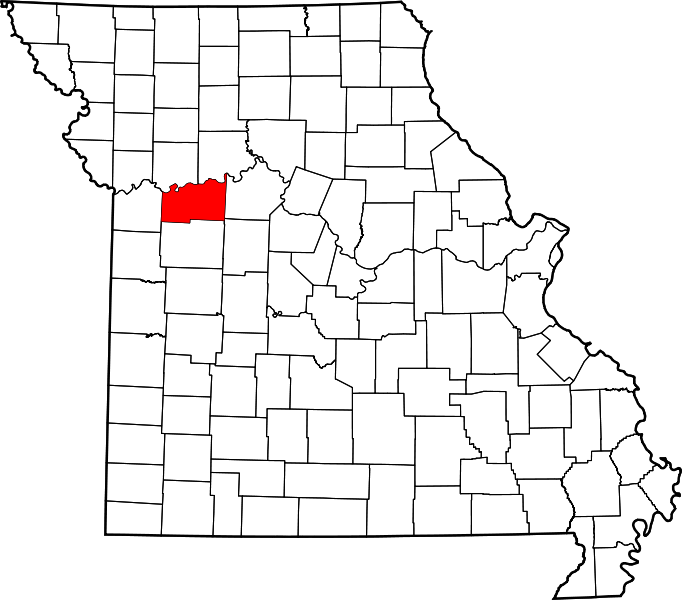
in 1812 and immediately began buying land patents west of Royse's Lick and south of George Brock along Blue River and Brock Creek. The Nixons bought 8 land patents between 1812 and 1817. 3 of these tracts were originally registered by them while the other 5 were acquired by assignment from other settlers who had not made final payment for their tracts. By the time the location of Salem had been selected as the seat of government for Washington County, the Nixons owned land on 3 sides of the yet to be town.  Today, the Salem Schools, Cornerstone Hall, GKN Sinter Metals,  the Salem Wastewater Treatment Plant, Wendy Heights Subdivision and Western Hills Golf Course are all located on land originally settled and developed by Zachariah and Martha Toms Nixon.

The Nixons were one of many Quaker families who came to the Indiana Territory from northeastern North Carolina along the north shore of the Albemarle Sound. Perquimans and Pasquotank Counties had been occupied by Quakers since the late 1600s.  George Fox who was the founder of the Society of Friends visited this area while on a missionary trip from England and helped establish the Quakers in this area and their 5 testaments of faith: Truth, Equality, Peace, Integrity and Simplicity.  The presence of slavery in North Carolina became a moral quandry for the Quakers and many of them came to Indiana and Ohio when the area was opened for settlement because the Ordinance of 1787 adopted by the Continental Congress forbade slavery in the Northwest Territory.  With all 3 judges of the first Washington Circuit Court being of Quaker pursuasion, with William Lindley's house being the temporary seat of government and with the name Salem being derived from the Hebrew word for "peace", the new county and county seat were being nurtured by the Society of Friends.


Monday, May 26, 2014

May 26, 1814

200 years ago today, Jesse B. Durham, John McAfee and Thomas Ewing were wondering if they would ever sell lots in their plat of Vallonia that they had laid out in 1810 near the fort.  They were still chafing that their plat had been given no consideration by the commission appointed by the Indiana Territorial Government to be designated as  the seat of government of Washington County, Indiana Territory.  They realized that they were in the northern part of this new county and that the Knobs were a formidable impediment to travel between their holdings and the rest of the county.  Yet, these settlers in the area of the Driftwood River had previously lobbied to have the Territorial Capital moved to their nascent town in 1813. There was public interest in moving the capital of the Indiana Territory in 1813 as there was a general fear that Vincennes was in a location that was exposed to attack by the British and their Native allies as long as the War of 1812 continued .


On February 12, 1813, the Territorial Legislature had passed a resolution to move the capital "to some convenient place in the Territory".  Durham, McAfee and Ewing were then disappointed to learn that the Legislature had voted on March 11, 1813 to move the capital to Corydon which had previously been their county seat before Washington County was formed. These Hoosier pioneers near Fort Vallonia took some satisfaction in the news that John DePauw had not yet sold any lots in the plat of Salem although they had been on sale since April 4, 1814.

Sunday, May 25, 2014

May 25, 1814

200 years ago today, William Lindley was operating a saw mill on Royse's Fork of Blue River downstream from that part of his 1813 land patent sold to John DePauw for the development of Salem as the seat of government of Washington County, Indiana Territory. He had hopes that the development of Salem would increase the demand for sawed lumber from his mill.  Between the years of 1812 through 1818 William and Mary Pitts Lindley received title to 7 different quarter sections in the vicinity of this fork of Blue River.  They were one of several Quaker families of entrepreneurial bent who had come from North Carolina to the Indiana Territory.  They were also among many of these Quakers who willingly participated in the civic development of Washington County in its first years.

The saw mill just west of Lindley's home which hosted the Washington Circuit Court for over a year was the first of 3 mills that William Lindley developed on Blue River before 1818.  This first mill was sold to William Rodman in 1824 who then made it a saw mill also.  Lindley developed a second mill on Blue River downstream from Fort Hill.  The rights to this registered land claim were assigned to Joseph Thornburg who actually took title to the site from the United States in June of 1817.  Thornburgh eventually sold the mill to merchant Jonathan Lyon in 1822 who then sold it to Eli Wright in 1832.  Eli Wright died from cholera on June 14, 1833 as did several of his neighbors along this reach of Royse's Fork.  Guardians Solomon Bower and Samuel Hinds arranged for the continued operation of this grist mill for several years for the benefit of Wrights children.  The third mill associated with William Lindley was located on Blue River between the other two.  Adam Cauble bought the mill and 160 acres on October 21, 1820 for $2,300. This mill was operated for over 50 years by 3 generations of Caubles as a grist and saw mill before it became a steam powered mill that made wagon spokes.

William and Mary Lindley followed the opening of the frontier in the State of Illinois and took out 4 land patents in Tazewell County near the newly established county seat of Pekin, Illinois.  Mill races and dam foundation stones remaining from the Blue River mills of  this Washington County Quaker pioneer are still visible in Bluer River today.


Saturday, May 24, 2014

MAY 24,  1814

200 years ago this month, William Hendricks was admitted to practice law before the 3 judge panel of the Washington Circuit Court.  He was a young attorney living in Madison having moved there from Cincinnati, Ohio in 1813.  Hendricks was raised in Westmoreland County, Pennsylvania where he schooled with future Hoosier politicians Jonathan Jennings and William Wick. When he moved to Madison he brought a printing press with him and started publishing the Western Eagle.  This was one of the two newspapers in which John DePauw advertised notice of the sale of lots in the new plat for Salem. Hendricks would eventually purchase 4 lots in Salem on July 21, 1815 for speculation.

Hendricks made few appearances before the local court as he became  the US Representatives in Congress after Indiana became a state in 1816.  He then became the second governor of Indiana in 1822 when he succeeded his childhood friend and fellow Madison resident, Jonathan Jennings. Hendricks then was elected as a US Senator for the State of Indiana by the Indiana General Assembly in 1825.   He defeated Isaac Blackford who was acting as the Clerk and Recorder of Washington County, Indiana Territory when Hendricks was admitted to practice before the court that was meeting in William Lindley's house south of the Salem plat.

William Hendricks served 12 years in the US Senate as an Anti Jacksonian an then returned to Madison to practice law and manage his considerable estate.  A brother was one of the founders of Shelbyville, Indiana.
His nephew Thomas Andrew Hendricks held offices in the Indiana General Assembly, US House of Representatives, US Senate and was eventually the 21st Vice President of the United States serving under President Grover Cleveland.


Friday, May 23, 2014


MAY 23, 1814

200 years ago this week in Washington County, Indiana Territory, Zachariah and Mary Magill McAllister were awaiting the visit of the delegation of Road Viewers to their cabin in Blue River Township. The judges of the Washington Circuit Court had determined on April 12, 1814 on their own motion to lay out a public road running from what was to become Salem to Charlestown in Clark County.  The proposed route was described as “from Salem, the nearest and best way across the Middle Fork of Blue River near Zachariah [McCollister] on said water course, thence the nearest and best way to the gap in the Knobs joining Clark County where the road now crosses that line to Charlestown generally called the New Trace Gap”.

The viewers appointed were John Brazelton, Phillip Hoggatt and William Lindley.  Their charge was to “view and report any conveniences or inconveniences that will result to individuals or to the public from any such road that shall be opened”. 

Brazelton was a neighbor of the McAllisters as his registered claim was just downstream on the Middle Fork.  He had been born in Frederick County Maryland and married to Sarah Bradley in Guilford County, NC. They then moved to Mercer County Kentucky and then to the Indiana Territory in 1811. William and Mary Thornburg Hoggatt were Quakers from Guilford County NC had settled on a tributary of Royse’s Fork of Blue River [Hoggatt Branch] that was later named after them.  Lindley, of course, was the temporary host of Washington County government while Salem was under development by John DePauw.  He was also appointed as the first County Surveyor so his being a road viewer was expected.


Zachariah McAllister was a Virginian of Scotch heritage on his father’s side and of German Pietist heritage on his mother’s side of the family.  The Scotch Irish and German Palatine cultures often intermarried in the Great Valley/Piedmont and Transappalachian frontier.  As McAllister had served in the 2d Regiment of the Indiana Militia the Judges of the Washington Circuit Court knew of him so as to name him as the waypoint for this new road. Mary Magill McAllister was expecting a child at this time.  She was hoping that her children would have the opportunity to learn to read so that they could protect the integrity of their name as present county records had their name as McAllister/McCollister/McEllister. The McAllisters would live out their lives on their farm and were buried in the Rodman Cemetery.


Tuesday, May 20, 2014


May 20. 2014

200 years ago today, Adam Housh was taking stock of his recently acquired inventory for the tavern that he had opened on his brother’s land in the Knobs above the old ford of the Muscatatuk River.  He had to pay a $2 annual licensing fee and $1 in clerk’s fees for the issuing of the license by the Judges of the Washington Circuit Court.  With the Federal Whiskey Excise Tax having been repealed in 1802, many distilleries cropped up all over the Indiana Territory so an ample supply of spirits should be readily available.  The first distilleries near Housh were operated by George Brock, William Gordon and John Fleenor.  Since John Fleenor had given the surety bond for the tavern license of Adam House, he expected Housh to be a ready market for his liquor product.  In April 1814, the Washington Circuit Court had entered an order setting the maximum prices that a tavern keeper could charge for his services and provender. These set prices were as follows:
                                                Bed,                                        6 ¼ cents per night
                                                Breakfast, dinner and supper  25 cents per meal
                                                Horse to hay and fodder         12 ½ cents per night
                                                Rum, peach brandy or wine    37 ½ cents per half pint
                                                All other spirits                       12 ½ cents per half pint
                                                “Cyder” and beer                    16 2/3 cents per quart

Housh was unclear as to whether 6 ¼ cents bought a private bed for the night or just 1 space in a bed as travelling men often had to sleep 2 to 3 to a bed.  Housh was also glad to be closer to Driftwood Township than other parts of the county as the Indiana Militia was often called out to foray north in search of rogue Indian raiders. Each Ranger was given a generous whiskey allowance while on duty.


Housh’s brother Andrew who owned the land where the tavern was located was expecting a visit from the Washington County Lister, Alexander Little.  He was to keep property lists for tax purposes and then file the list with Isaac Blackford as the Clerk of the Court. Sheriff William Hoggatt then collected the taxes and reviewed compliance with charges such as the tavern rates.  As Little had planted the first peach orchard in the county, he was pleased with the rate set for peach brandy  by Judges Jonathan Lindley, Simeon Lamb, and Moses Hoggatt.

Monday, May 19, 2014


MAY 21, 1814

200 years ago today, John and Nancy Perlier(Purlee) Wright were making note of the 1st birthday of their daughter Elvira Levina Wright who was born on May 21, 1813. She was born in the Fort Hill block house built on one of the land patents of her grandfather Amos Wright, Sr. during the Indian uprising led by Tecumseh and his brother Tenskatawa (The Prophet).  During the years of 1811 and 1812, Governor William Henry Harrison ordered settlers throughout the Indiana Territory to build stockaded forts at strategic points for common protection.

Amos Wright and his extended family of sons, brothers and brothers in law erected their fort near the trail between Beck’s Mill and Royse’s Lick near a steep bluff overlooking a sharp bend the Royse’s Fork of Blue River.  This fort was located near Wright’s south property line near a steep ravine that led to a good supply of water gushing forth from a cave spring.  Amos Wright, Sr. had obtained his deed for this quarter section from the United States on August 27, 1812.

During these years, the Indiana Militia would issue alerts of threatened depredation and the families would gather in the fort.  During these episodic times of communal life, the men would go off to work in the fields or clear their new settlements during the day while the women and children would remain in or near the fort attending to household matters.  The families that were sheltered at Fort Hill during this time included: William and Martha Morgan Wright; Amos and Margaret Davis Wright; Philburt and Mary Sears Wright; John and Nancy Purlee Wright; Philip and Anna Patsy Wright Copple; Peter and Racheal Woods Wright;  and Josiah and Sarah Wright Johnson.


Sunday, May 18, 2014

MAY 18, 1814

200 years ago today John and Isabella Gray Sapp were preparing to make a trip to the Jeffersonville Federal Land Office to make their final payment on their pioneer homestead on the headwaters of Mill Creek in Washington Township, Washington County, Indiana Territory.  John Sapp was a native of Maryland. He and Isabella were married in Madison County, Ky on January 6, 1791. After the death of his father in 1805, they moved to Clermont County, Ohio which was the 8th oldest county established in the entire Northwest Territory.  This family of 7 soon learned of new land in the Indiana Territory.  They then would have either trekked west in 1811 along Kibbey’s Trace which ran from Cincinnati to Vincennes or have taken a flatboat from Cincinnati to Jeffersonville.  After a few days of temporary encampment near Royse’s Lick, their homestead was selected on the border of the Norman Upland and the Mitchell Plain.  Soon after their settlement, their daughter Mary Katherine married Christopher Purkhiser.  The Sapps were making their living as farmers at the time cholera came to England from India in 1832. When the scourge of cholera came to the Midwest in the summer of 1833, both of them died in this epidemic on July 14, 1833.  They are buried at the Mill Creek Cemetery.


Saturday, May 17, 2014

MAY 17, 1814

200 years ago this week, John Storm, Cornelius Williamson and James Hutchinson were attempting to execute their duties as Road Viewers.  They had been appointed by the Washington Circuit Court to determine the best route for a road that was the subject of a petition filed by Thomas Ewing of Driftwood Township on April 12, 1814.  Ewing on behalf of settlers in his neighborhood at the northern end of Washington County, Indiana Territory was seeking to have a public road established from “Joshua Lindsey to Vallonia by way of John Kethcum and James Hutchinson;  thence the nearest and best way to the Muscatatak at the old ford;  thence up the best way up the ridge by Andrew Housh;  thence to Samuel Lindley’s Horse Mill; thence in a direction toward Charlestown as far as the county line”.

When John DePauw heard of this, he wondered why these Driftwood residents didn’t petition to have the road run to his plat of Salem.  The obvious was pointed out to him as Charlestown existed as the county seat of Clark County but Salem was only a plat and not yet an actual town. On the other hand, Samuel Lindley was pleased with the route as he had recently purchased the horse mill near Royse’s Lick from Moses Hoggatt.  Adam Housh’s tavern on his brother’s property was also likely to prosper if the road was laid out as Ewing intended.


The pending report of Storm, Williamson and Hutchinson as to their determination of the route for this road was a matter of general interest as many were curious as to how they planned to climb the Knobs from the Muskatatuk River.


Thursday, May 15, 2014

MAY 15, 1814

200 years ago today, Thomas Hopper was planting crops on his 2 quarter sections which were located where the road from the Falls of the Ohio to Vincennes crossed Lick Creek which was a tributary of the Patoka River. Hopper had moved northwest up the Vincennes Road from his first place of settlement which was where Sinking Creek crossed this pioneer trail. This is where Hardinsburg is now located. Once Washington County had been established, Hopper could boast that at that location he was the first settler in the county. Hopper had come from North Carolina in 1803 and settled on land that was not yet controlled by the Federal Government. Hopper stayed at this remote location while the Grouseland Treaty was negotiated and while the subsequent surveys were done so that the land could be officially opened up for settlement. Hopper registered his claim to his first home in the Indiana Territory and then assigned it to Robert Hollowell after relocating. Hopper’s 2d residence would become the site of Paoli which was founded in 1816. Preferring not to be near any town, Hopper then moved west again to Lafayette County, Missouri where he would amass a large landholding of over a 1000 acres.


Wednesday, May 14, 2014


MAY 14, 1814

200 years ago today, Jonathan Hensley was among the newly appointed township officials contemplating their new duties. Jonathan Lindley, Godlove Kamp and Simeon Lamb as the Judges of the Circuit Court had been given a wide range of powers by the Indiana Territorial Council and Governor of both a judicial and administrative nature.

They divided Washington County into 5 townships: Madison, which was the southwestern part of the county; Lost River, which was the northwestern part of the county; Blue River, which was the southeastern part of the county, Washington which was the central and eastern part of the county; and Driftwood which was the northern part of the county.

 The Circuit Court Judges then named various township officers. Overseers of the school sections were named. They were to manage the renting of each Section 16 for eventual funding of public schools. Overseers of the Poor were also named although they had no funds to provide to the needy. Constables were named for each township. They were to carry out orders of the court and the justices of the peace.

 Jonathan Hensley was named as the first constable of Washington Township. In 1814, he was working to pay for his homestead claim just southeast of Royse’s Lick on the north slope of Spurgeon Hill. His brother Jimmy and friend John Menaugh had been kidnapped 3 years before by the Delaware Indiana Tow Head who was the son of Old Ox. One of the boys died during their period of captivity and upon the return of the survivor after the Battle of Tippecanoe, there was uncertainty as to which boy survived. It was determined by an ad hoc jury of settlers around Royse’s Lick that John L. Menaugh was the survivor.


Monday, May 12, 2014

MAY 12, 1814

200 years ago today in Washington County, Indiana Territory, Adam House/Housh was operating a tavern under the first tavern license issued by the Washington Circuit Court on April 11, 1814. His friend John Fleenor put up the financial guarantee which was required for the license to be issued. Housh had reputedly built the first cabin in the area in 1809 where the Indian trail crossed the ridge that ran north to the Muscatatuk from Brock Creek but he never entered any title claim. The tavern was located on the homestead of his brother, Andrew House/Housh at the top of the Knobs above the old Muscatatuk ford. The House/Housh brothers were of German heritage as their father immigrated to the American Colonies from the Wurtemburg area of Germany. House/Housh must not have been dedicated to a career as a purveyor of spirits as he soon enlisted in the Company of the US Mounted Rangers commanded by Captain James Biggers of Clark County, In. As a Ranger, House/Housh was paid $1 per day, and was required to supply his own horse, ammunition, tomahawk, a large and small knife, and a leather belt.[2]Adam House later moved on to Knox County, Illinois where he died in 1861.


Sunday, May 11, 2014

MAY 11, 1814

200 years ago today William Logan and his son, Ezekiel D. Logan, were concerned about the lack of roads in their recently created county of residence in the Indiana Territory. When William and Sarah Grantham Logan came to the Indiana Territory from North Carolina by way of the Cumberland Gap and the Wilderness Road, they nning from the Wabash villages southeast to the trading post at Tully’s Town (Springville) between the Knobs and the Ohio River. The land selected was in Clark County at the time and the seat of government had recently been moved from Jeffersonville to Charlestown in 1808. The trail gave them access to the county seat and also the Falls of the Ohio. When their land soon became part of Harrison County, there was no direct route to get to Corydon so hopefully there was no need for a court. When Indian depredations occurred on Walnut Ridge and the Driftwood River in 1811/1812, the trail was a liability and a stockade/fort was built on their land just southwest of present day Kossuth. Now that the risk of Indian attack had subsided after Tippecanoe and the Mississenwa campaigns and as Salem was to become the seat of government closer to the Logans, the need for a better road was essential. The Logans had heard that neighbors north of the Muscatatuk were going to petition the Washington Circuit Court judges for the blazing of a road to Salem. They hoped that such a road would cross over the eastern part of their homestead. selected a location on a ridge where it was traversed by the Indian trail running from the Wabash villages southeast to the trading post at Tully’s Town (Springville) between the Knobs and the Ohio River. The land selected was in Clark County at the time and the seat of government had recently been moved from Jeffersonville to Charlestown in 1808. The trail gave them access to the county seat and also the Falls of the Ohio. When their land soon became part of Harrison County, there was no direct route to get to Corydon so hopefully there was no need for a court. When Indian depredations occurred on Walnut Ridge and the Driftwood River in 1811/1812, the trail was a liability and a stockade/fort was built on their land just southwest of present day Kossuth. Now that the risk of Indian attack had subsided after Tippecanoe and the Mississenwa campaigns and as Salem was to become the seat of government closer to the Logans, the need for a better road was essential. The Logans had heard that neighbors north of the Muscatatuk were going to petition the Washington Circuit Court judges for the blazing of a road to Salem. They hoped that such a road would cross over the eastern part of their homestead.


 MAY 10, 1814

200 years ago today, Joseph and Susannah Steen Latta were engaged in negotiations over the renewal of their lease in School Section 16 located immediately west of Royse’s Lick and south of Moses Hoggatt’s horse mill. In the Land Ordinance of 1785 enacted by the Continental Congress, Section 16 in each congressional township was to be set aside as public land for the support of public education.

Section 16 in each congressional township was to be set aside as public land for the support of public education. These lands were leased out by government agents with the rental income to pay maintenance of schools. The first recorded real estate transaction in the Harrison County real estate records was on March 9, 1809 for the lease of the NE quarter of Section 16 in T2N, R4E to Joseph Latta for a term of 5 years. One of the early acts of Jonathan Lindley as the First Judge of the recently created Washington Circuit Court was to appoint Samuel Lindley and Godlove Kamp as trustees to establish the terms of a new lease with the Lattas for that part of the quarter section “located east of the partition fence between the 2 cleared fields”. Lindley and Kamp recommended that the Lattas have their lease renewed for this part of the original lease for 2 years for no compensation in consideration of extra improvements made on the real estate. The Court then authorized the Trustees to offer the rest of the quarter section to the Lattas for terms that were “fair and just”. If the Lattas declined, then the Trustees could lease the remainder of the quarter section to anyone at their discretion for terms “thought best”. The fact that 2 of the Latta sons, William and John, had served in the Indiana Militia under Captains John Royse and William Hoggatt was probably also taken into consideration.
...These lands were leased out by government agents with the rental income to pay maintenance of schools. The first recorded real estate transaction in the Harrison County real estate records was on March 9, 1809 for the lease of the NE quarter of Section 16 in T2N, R4E to Joseph Latta for a term of 5 years. One of the early acts of Jonathan Lindley as the First Judge of the recently created Washington Circuit Court was to appoint Samuel Lindley and Godlove Kamp as trustees to establish the terms of a new lease with the Lattas for that part of the quarter section “located east of the partition fence between the 2 cleared fields”. Lindley and Kamp recommended that the Lattas have their lease renewed for this part of the original lease for 2 years for no compensation in consideration of extra improvements made on the real estate. The Court then authorized the Trustees to offer the rest of the quarter section to the Lattas for terms that were “fair and just”. If the Lattas declined, then the Trustees could lease the remainder of the quarter section to anyone at their discretion for terms “thought best”. The fact that 2 of the Latta sons, William and John, had served in the Indiana Militia under Captains John Royse and William Hoggatt was probably also taken into consideration. See More

Tuesday, May 6, 2014

MAY 6, 1814

200 years ago Henry Wyman, Leonard Karnes and John Bush were well established on their homesteads on a tributary of the Mutton Fork of Blue River in Blue River Township, Washington County, Indiana Territory. These 3 settlers were from Hesse in what would become Germany and had come to America as mercenary soldiers during the Revolutionary War. They had come to the Indiana Territory from Rowan County, North Carolina. These men must have been of influence as the creek along which they had settled was soon called Dutch Creek. This name was taken from “Deustch” which is the word for German self-description. These men of Teutonic heritage had noticed how many of their neighbors who were the children and grandchildren of fellow German immigrants were losing their accents and abandoning their connection to Lutheran and Brethren [Dunkard].


Sunday, May 4, 2014

MAY 4, 1814

200 years today the Circuit Court of Washington County, Indiana Territory was still meeting at William Lindley’s house south of the plat of Salem which was still being cleared and was practically inaccessible to most of the new settlers. To alleviate this problem, Governor Thomas Posey appointed 19 residents of our new county to act as Justices of the Peace in April 1814. These appointees could read and write and were able to prepare basic legal documents, conduct marriages, rule on disputes with a value of less than $5 and enter convictions for minor crimes and impose nominal fines. They conducted these proceedings in their homes and were located throughout the County from the Harrison County line to the Driftwood River. Their decisions could be appealed to the Circuit Court. These Justices of the Peace were: Jesse Spurgin; James Young; Robert Ellison; John Wright; David Fouts; Robert Catlin; Amos Thornburgh, William Robertson, Jesse Roberts, Samuel Chambers, Zachariah Lindley, Edmund Hunter, John Beck, Enoch Parr, John Coleman; Godlove Kamp, Samuel Huston, John Ketchum, and Cornelius Williamson.


Saturday, May 3, 2014

MAY 3, 1814

200 years ago today the United States and Great Britain were at war. The British in Canada continued to encourage and support the opposition by the Indians of the former Northwest Territory of the United States to the expansion of the American frontier. Although the Western Theatre of the War of 1812 was fought on the perimeter of the new state of Ohio and the territories of Indiana, Illinois and Michigan, a territorial militia was considered necessary and was actively maintained. While the Indiana Territory was deemed safe for settlement after William Henry Harrison was successful at the Battle of Tippecanoe in November 1811 and Tecumseh’s dream of a great Indian nation in Indiana died with him at the Battle of Thames in Ontario in 1813, the Pigeon Roost Massacre of September 1812 reminded residents of Washington County that a ready defense was still required as coexistence of the Native and European cultures was unlikely. The northern boundary of Washington County adjoined territory that was still claimed by Indians and it was not opened to settlement until after the Treaty of St. Marys was signed on October 16, 1818. The 9th Regiment of the Indiana Territory Militia that patrolled Washington County in May 1814 was led by: Colonel John DePauw; Captains Thomas Denny, Samuel Huston, Absalom Sargeant, George French, John Beck, Henry Dawalt, Charles Busey, and John Royse; Lieutenant Thomas Pitts, and Ensign John Cooley.


Friday, May 2, 2014

MAY 2, 1814

200 years ago, some of the Lenni Lenape (Delaware Indians) who had lived in that part of the Indiana Territory that became Washington County were adjusting to life in the Missouri Territory near Cape Girardeau on the Mississippi River. Local settlers such as Frederick Royse and Jesse Spurgeon often wondered where Old Ox and his band of Delawares had gone after they were encouraged to leave the area after the Pigeon Roost Massacre of September 1812. Some wondered what the native name of Old Ox was. It was believed he may have been the Delaware chief called The Beaver who had signed the Treaty of Grouseland on August 21, 1805 along with three other Delaware chiefs named Hockingpomska, Kecklawhenund, and Allime. Amo’chk was the Lenni Lenape word for beaver and it was pronounced to sound like “ah mox”. In the Treaty of Grouseland, Governor William Henry Harrison had purchased the rights to settle what became Washington County, Indiana. After its survey was completed, the area was open for official settlement in 1807.


Thursday, May 1, 2014

MAY 1, 1814

200 years ago the settlers in Washington County, Indiana Territory had real problems in protecting their livestock. There was very little grazing land available because of the forest cover of the Knobs, the Norman Upland and the Crawford Upland. Livestock ranged at large foraging through the forests which were slowly being cleared. Wolves were prevalent and were threats to man and domestic beast. Split rail fences could contain some cattle but could not protect them from the wolves. Some settlers kept their best cows in the cabin with them during the winter to protect them from the wolves. Once log barns were built, the cattle were better protected in the winter. The settlers discussed petitioning their lawmakers for the enactment of a wolf bounty.